Travel map animation maker
Turn an itinerary into an animated route: road, ferry and flight legs, a label at every stop, and a camera that follows the trip. Describe it in plain English and export a video.
Who it is for
Travel vloggers
An intro or chapter map that shows where the episode goes.
Travel bloggers and agencies
An itinerary that a reader understands in a few seconds.
Anyone back from a trip
A route recap to share in 16:9, 9:16 or 1:1.
Travel map animation examples
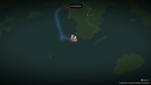
Greek Island Hopping
A day-by-day Aegean itinerary — driving and ferry legs with a label at every stop.
- Engine:
- Flat
- Map Style:
- Chalkboard
- Aspect Ratio:
- 16:9
Prompt used for this videoStart from Greece. Fly to Athens. Add a label on Athens that says "Athens - day 1". Pause for 2 seconds. Trace a driving route from Athens to Piraeus, then a ferry route from Piraeus to Mykonos. Fly to Mykonos with 55 degrees tilt and orbit it. Add a label on Mykonos that says "Mykonos - day 3". Take the ferry from Mykonos to Naxos. Add a label on Naxos that says "Naxos - day 5". Zoom out to show the Aegean Sea.
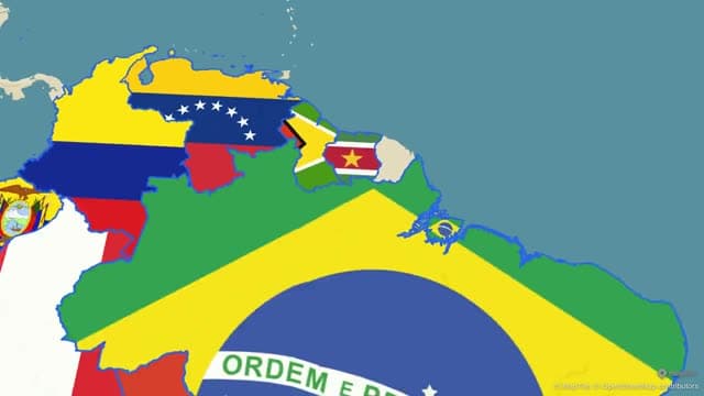
South America Country Tour
Glide down the continent, filling all twelve South American countries with their flags.
- Engine:
- Flat
- Map Style:
- Fantasy
- Aspect Ratio:
- 16:9
Prompt used for this videoStart with a wide camera frame of South America for 3 seconds. Slowly glide down the continent. Sequentially pan to, zoom in, and highlight each country for 2 seconds in this exact order: Brazil, Argentina, Colombia, Peru, Chile, Ecuador, Bolivia, Paraguay, Uruguay, Venezuela, Guyana, and Suriname. End with a wide 3-second shot of the full map with all 12 countries highlighted.
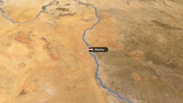
The Nile, Source to Sea
Trace the Nile from Lake Victoria to the Mediterranean, labelling every city on the way.
- Engine:
- Flat
- Map Style:
- Satellite
- Aspect Ratio:
- 16:9
Prompt used for this videoStart from Africa. Fly to Egypt and trace its border, pause for 2 seconds. Trace the course of the Nile from Lake Victoria to the Mediterranean Sea. Add labels on Khartoum, Aswan, Luxor and Cairo, pausing 2 seconds after each. Fly to the Nile Delta with 50 degrees tilt, draw a polygon around the delta filled with green at 40% opacity, and add a label "Nile Delta - 95% of Egypt lives here". Pause for 3 seconds, then zoom out to show the whole river.
One trip, several ways to travel
The Route action draws your trip leg by leg between real places. Fill in From and To, add a waypoint for each stop, and choose the route mode. Driving follows real roads. Maritime is for ferries and sea crossings. Air/Direct draws a flight or a straight line. Rail draws a named rail route that you pick from a list.
One Route action has one mode, so a trip that mixes a drive and a ferry is two actions, one after the other. The Greek island clip on this page does that: a driving leg, then ferry legs from island to island, with a label at every stop.
Each leg has its own colour, width, opacity and pattern. In the Head settings, put an arrow or an icon at the tip of the line (a car, a ship, a plane), or a 3D model.
Stops, labels and days
Label marks each stop with a name, a date or a "Day 3". The Icon/Model action drops a pin, a flag or a 3D model on a place. Pause holds the view so the stop can be read before the route moves on.
Border and Land outline or fill the country you are visiting, and Land can fill it with its flag. The South America clip on this page fills one country after another with its flag as the camera glides down the continent.
A camera that follows the trip
A route never moves the camera by itself. Add Fly along and the camera rides the line. Use Fly to and Orbit to arrive at a stop and circle it, and Tilt for a view across the terrain.
Routes are not only roads. The Nile clip on this page traces the river from Lake Victoria to the Mediterranean and labels the cities on the way.
Start from a prompt or from a tour template
The fastest start is a sentence: the stops, how you travelled between them, and what to label. Animaps turns it into steps that you can edit one by one, so a wrong stop or a slow leg is a small fix and not a new attempt.
The Country Tour and City Tour templates are finished tours that you re-point at your own destination. Each clip on this page lists the map style it was rendered with, from satellite imagery to a chalkboard look.
Templates to start from
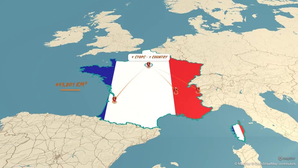
Country Tour
A 40-second tour of a country: its border and population, the capital, a road trip between two cities, a mountain, a wine region, and a flag finale — with sounds and music. Edit the places to tour any country.
Open in the studio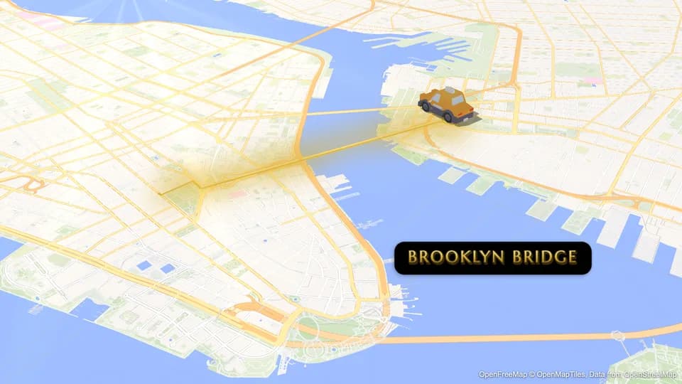
City Tour
A 40-second tour of a city: its limits and population, its districts, a downtown close-up, a park, a drive across a landmark bridge and a monument finale — with city sounds and music. Edit the places to tour any city.
Open in the studio
Example prompts to start from
These are starting points to edit, not the prompts behind the clips above. A link opens the studio and starts the generation.
- Road trip from Lisbon to Madrid to Barcelona by car, with a label at every stopTry it in the studio
- Start from Greece. Trace a ferry route from Piraeus to Santorini, add a label on Santorini that says "Santorini - day 2", then orbit the islandTry it in the studio
- On a 3D globe, trace a flight from London to Bangkok with a plane icon, then trace a driving route from Bangkok to Chiang MaiTry it in the studio
- Start from Italy. Fly to Rome, then to Florence, then to Venice, pausing 2 seconds at each city, then zoom out to show ItalyTry it in the studio
Questions and answers
Can I mix driving, ferry and flight legs in one video?
Yes. One Route action has one route mode, so add one action for each way of travelling. They play in the order you set, in the same animation.
Does the driving route follow real roads?
Yes. Driving mode routes along roads between your stops. Air/Direct draws a straight or curved line instead, which suits flights and rough sketches.
How many stops can one route have?
One Route action holds up to 10 places, the start and the destination included. For a longer trip, add a second Route action that starts where the first one ends.
Can a car, a plane or a boat move along the route?
Yes. In the Head settings of the route, choose Icon and pick one from the library, or pick a 3D model. It rides the tip of the line as the route draws.
Can I make a vertical travel map for Reels, Shorts or TikTok?
Yes. Pick 16:9, 9:16 or 1:1 before you export and the camera frames for it. Exports are MP4 video, or a GIF for clips up to 6 seconds.
Can I make a travel map animation for free?
Yes. The Free plan exports 1080p video up to 30 seconds long, with an Animaps watermark. Paid plans remove the watermark and allow longer videos.
Plans and limits are on the pricing page.
Learn the method
More map animations to make
- War map animation
- History map animation
- Flight path animation
- Map animation maker: every action and export option in one place
- Demo gallery: more clips, each with its own page