Map Animation Tools: How to Create Animated Maps in 2026
What a map animation tool has to do, every Animaps capability in plain English, how creators use it, and a four-step workflow from a written sentence to an exported MP4.
Preview & Editor advantage
Draft with AI prompts or templates, then refine every animation step in real time (zoom, opacity, border width, colors, bearing, tilt). Credits are used only when you render the final video.
Animaps Team
Content Creator
Map Animation Tools: How to Create Animated Maps in 2026
Last updated: August 16, 2026
TL;DR
A map animation tool turns a place and a sentence into a moving map video — camera flights, country borders, flag fills, routes, labels — without After Effects, plugins or keyframes. [Animaps](/) is the map animation tool that lets you preview and edit every step before you spend a credit, which is why creators use it for videos that end up going viral.
Quick links:
- Create your first animation: Map animation maker
- See it moving: Map animation examples gallery
- Compare the field: Map animation maker alternatives
- Prompt library: AI map prompts
What you get in this guide:
- What a map animation tool actually has to do
- Every Animaps capability, in plain English
- What creators are shipping with it
- A four-step workflow from blank page to exported MP4
- Free vs paid, and how credits work
What a map animation tool has to do
"Map animation" covers a lot of ground, and most tools only cover part of it. Before you pick one, it helps to know what the job actually involves.
A complete map animation tool needs to:
- Find the place. Type "Reykjavik" or "Ottoman Empire" and get the right geometry — not a pin dropped at a guessed coordinate.
- Move the camera. Fly, pan, zoom, tilt, orbit, dolly. This is what makes a map feel like a film rather than a slideshow.
- Draw on the map. Borders, filled countries, flags, shaded regions, labels, icons, hand-drawn arrows.
- Trace routes. Real roads for a road trip, sea lanes for a shipping story, flight arcs for a travel recap.
- Show you the result before you pay. Rendering video costs money. If you can only see the output after the render, every mistake costs you.
- Export where you publish. 16:9 for YouTube, 9:16 for Shorts, Reels and TikTok, 1:1 for feeds.
Point 5 is the one that separates the field. Most AI map tools take your prompt, render a video, and hand it back. If the zoom is wrong, you re-prompt and re-render, and pay again. Animaps generates the animation as an editable sequence of steps you play in the browser first.
Animaps, feature by feature
Three ways to start
AI prompt. Describe the animation in a sentence — "start over Europe, fly to France, trace its border, then reveal its regions one by one" — and get a full animation in about 30 seconds. Nothing is baked into a video yet; every step is still yours to change.
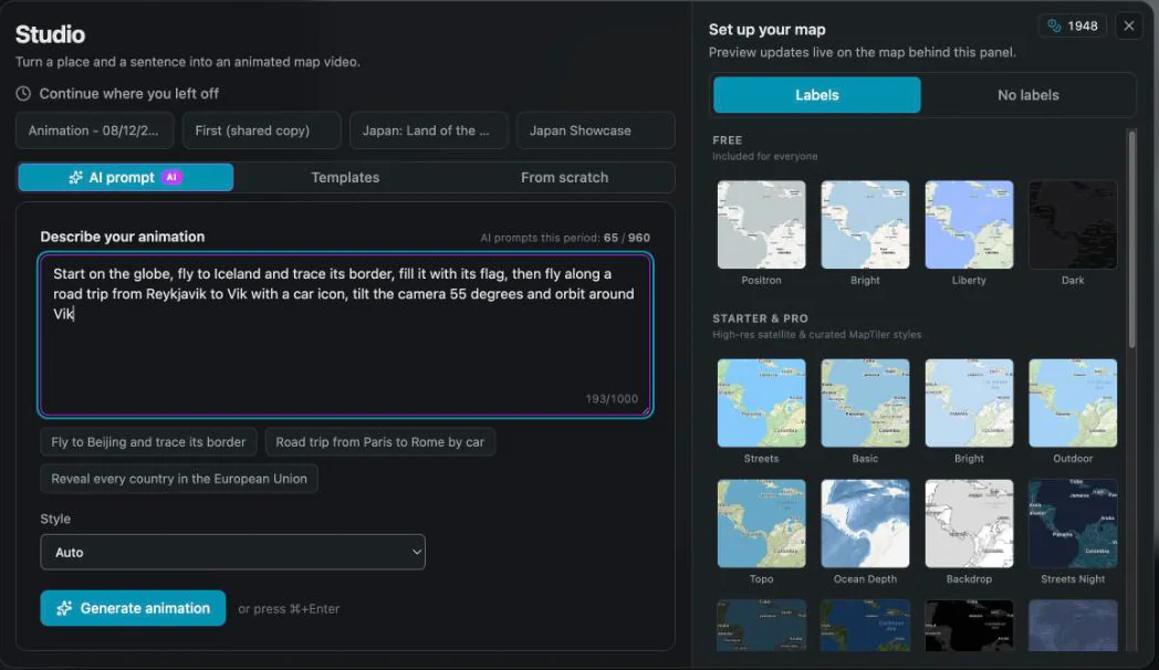
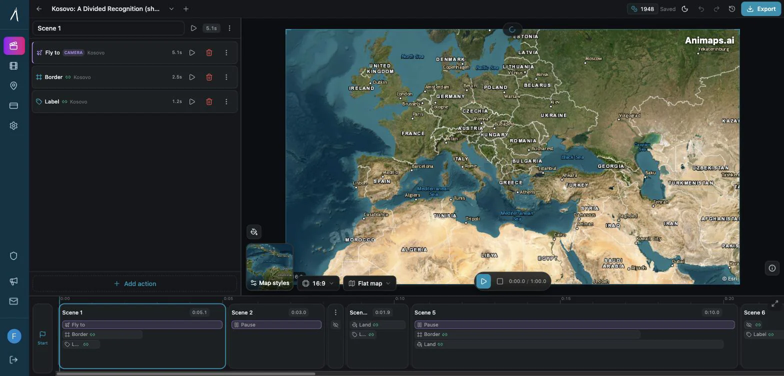
Editor. Build from an empty timeline, or take the AI draft apart. Every step exposes its own location, duration, camera angle, colours and easing.
Templates. Start from a ready-made structure — a country tour, a city tour, or a historical empire — and swap in your own places.
The three are interchangeable. Prompt first, refine in the editor, save the result, reuse it next week.
21 animation types
| Category | What it covers |
|---|---|
| Camera | Fly to, pan, zoom in/out, rotate, tilt — plus orbit, arc and drone |
| Borders | One border step that shows, traces or pulses, plus a historical border timelapse |
| Land | One land step that fills, pulses or reveals (solid colour or the country's flag), plus region shading |
| Paths | Follow a drawn path, or trace a road, air, sea or rail route |
| Elements | Labels, icons and 3D models, hand-drawn shapes, atlas layers |
| Others | Pause, hide layers |
Steps can also be grouped into scenes, so several things happen at once — a camera orbit while a border traces and a label drops in — instead of queuing one after another.
Flat map and 3D globe
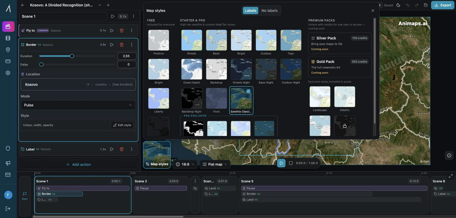
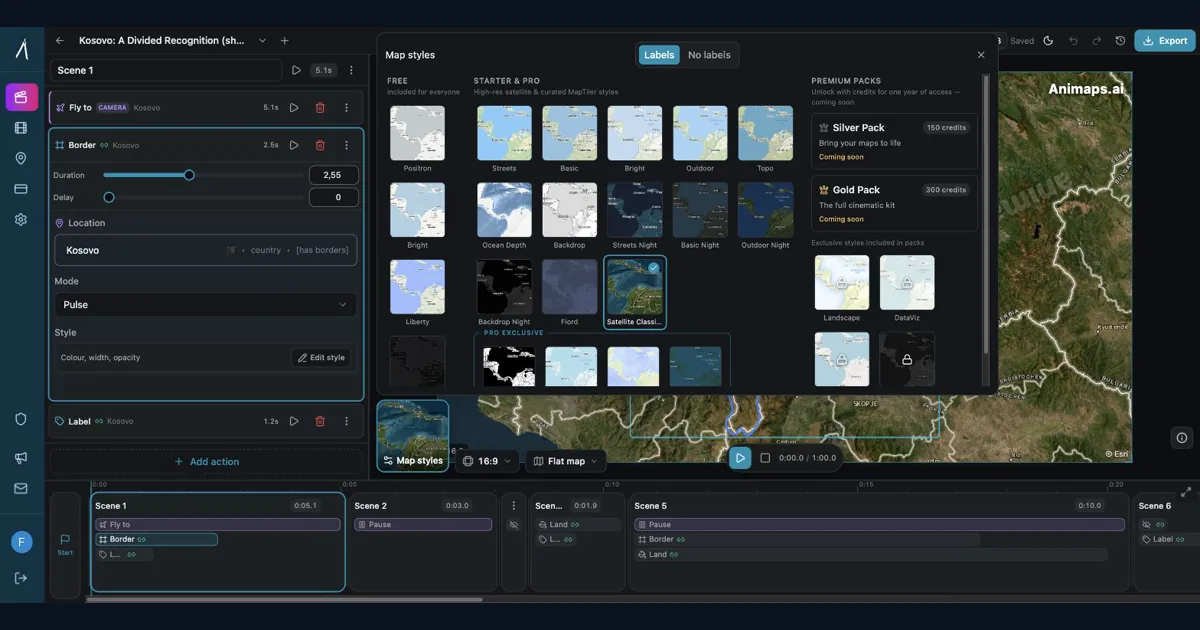
The same animation plays on a flat Mercator map or on a 3D globe, and you switch with one control. Twenty-six map styles ship with the product, from clean Positron and Dark through topographic, satellite and night variants.
Real routes, not straight lines
Route steps follow actual roads for driving, real sea lanes for maritime legs, and rail corridors for train journeys — with a vehicle icon that travels the path. A road trip from Reykjavik to Vík bends around the coast the way the road does.
A searchable place database
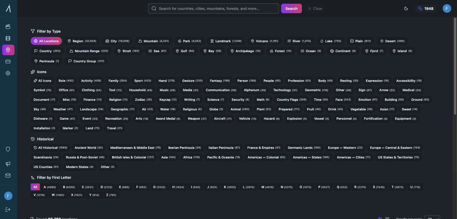
Every animation starts from a real place, so the places have to be there. The locations browser holds 66,780 places — countries, regions, cities, mountains, parks, landmarks, volcanoes, rivers, lakes, straits, seas and more — plus 1,593 historical entities covering empires, colonial territories and past states.
Historical borders
Historical entities carry real period geometry rather than a modern outline nudged into place, so you can watch an empire expand, recede, or a modern border change year by year.
Labels, icons and flags
Country flags fill land shapes and sit on city markers. Thousands of icons cover transport, landmarks, military, weather and sport. Labels support their own fonts, sizes, colours and entrance animations, and can be pinned to a place or to the screen.
Preview before you pay
This is the part that matters most in daily use. Credits are spent at export time only. Generating, editing, restyling, re-timing and replaying an animation costs nothing. You render once, when it already looks right.
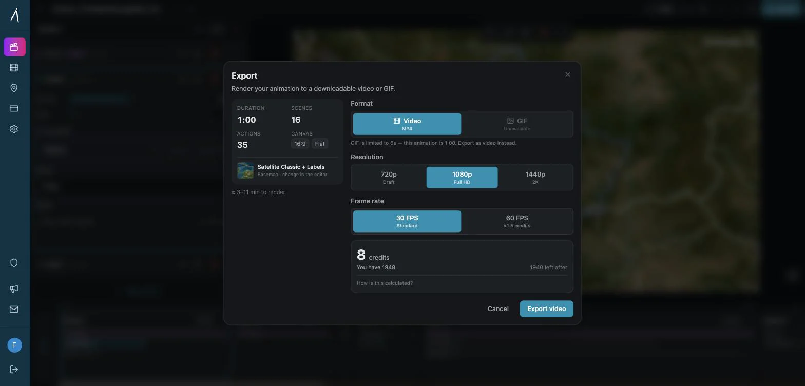
Export
- Resolutions: 720p, 1080p, 1440p
- Frame rates: 30 or 60 FPS
- Aspect ratios: 16:9, 9:16, 1:1
- Formats: MP4 and GIF
What creators are shipping with it
The clearest signal that a map animation tool works is what happens after people publish.

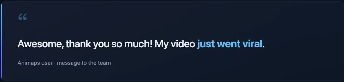
The pattern behind messages like these is consistent: geographic context is one of the most watchable things you can put in a video, and it used to take hours to produce. Map animations now sit in:
- YouTube explainers — establishing shots that show the viewer where a story happens
- News and geopolitics — border changes, conflict maps, supply routes
- Travel content — road trips, flights and cruises traced across the map
- Education — empires rising and falling on a timeline students can follow
- Business — expansion maps, delivery networks, coverage areas
How to create a map animation, start to finish
1. Describe it
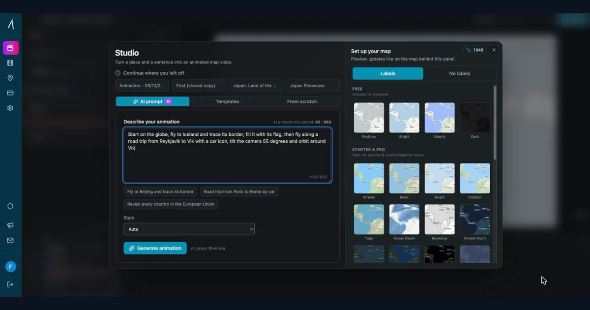
Open the studio and write what you want to see. Plain English, no coordinates:
"Fly to Beijing and trace its border" "Road trip from Paris to Rome by car" "Reveal every country in the European Union"
Pick a map style on the right, and generate.
2. Watch it play
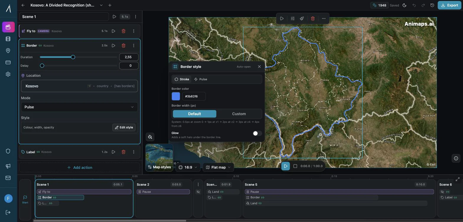
The animation appears as a list of steps with a live preview. Play the whole thing, or test a single step. Nothing has been rendered yet.
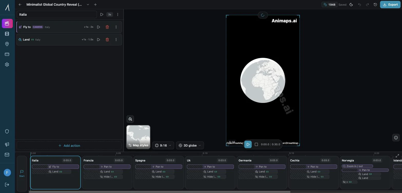
3. Change what you don't like
Click any step to open it. Change the location, retime it, tilt the camera further, recolour a border, swap a solid fill for a flag, add a label, drag a step to a different point in the timeline. The preview updates as you go.
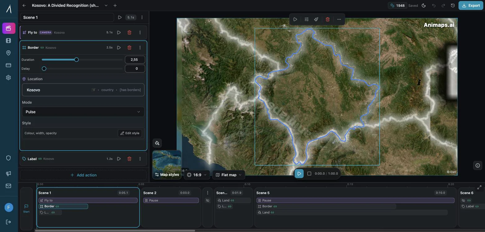
4. Export
Choose resolution, frame rate and aspect ratio, and export. The MP4 lands in your animations library, ready to drop into your editor.
Typical time from blank page to exported video: under five minutes, most of it spent deciding what you want rather than fighting software.
How Animaps compares to other map animation tools
| Tool | Creation method | Preview before render | Editor | Starting price |
|---|---|---|---|---|
| Animaps | AI + editor + templates | Yes — full preview | Yes — every step | Free / $9.90 |
| AnimateMyMap | Manual camera modes | Partial | Yes | Not published |
| Mapimator | AI + keyframes | No — render to see | Yes — keyframes | Free / $12 |
| MapAnimation.io | AI prompt only | No | No | Free tier |
| EasyMotion | AI chat only | No | No | $10 |
| Google Earth Studio | Manual keyframes | Yes — 3D only | Yes — needs approval | Free |
| After Effects + GEOlayers | Manual keyframes | Yes | Yes | ~$23 + $200 |
Deeper comparisons: Animaps vs AnimateMyMap · Animaps vs Mapimator · Animaps vs GEOlayers · Best After Effects alternatives
What it costs
| Plan | Price | Credits per month | Max resolution | Watermark |
|---|---|---|---|---|
| Free | $0 | 12 (about 6 videos) | 1080p | Yes |
| Starter | $9.90/mo | 80 (about 40 videos) | 1080p | No |
| Pro | $19.90/mo | 180 (about 90 videos) | 1440p | No |
Annual billing saves 20%. Unused credits roll over (up to 15 on Starter, 40 on Pro). Creating, editing and previewing are always free — you are only charged when you export.
Frequently asked questions
Is there a free map animation tool? Yes. The Animaps free plan includes 12 credits per month, which is about six animations at 1080p, with a watermark. Writing your own prompts, editing steps and previewing are unlimited and free.
Do I need After Effects? No. Animaps runs entirely in the browser and exports finished MP4s. Many creators still drop those MP4s into a video editor afterwards, but nothing about the map animation requires After Effects or a plugin.
Can I make vertical map animations for TikTok and Shorts? Yes — 9:16 and 1:1 are export options alongside 16:9, and the framing is applied in the preview so you see the crop before you render.
Can it animate a road trip on real roads? Yes. Driving routes follow the actual road network, maritime legs follow real sea lanes, and a vehicle icon travels along the path.
How accurate are the historical borders? They come from historical geometry datasets rather than modern outlines nudged into place. The locations browser lists 1,593 historical entities, grouped by era and region — ancient world, colonial empires, post-Soviet states, US counties and territories, and more.
What if the AI gets it wrong? You fix it in the editor rather than re-rolling the prompt. Every step's location, timing, camera and styling is editable, and you can add or delete steps. Because credits are only spent at export, iterating costs nothing.
Start with one animation
Pick a place you already talk about in your videos, write one sentence describing the shot you want, and see what comes back.
Tags
Related reading
Best AI Map Animation Tools Compared (2026)
Most AI map tools work the same way: type a prompt, render, hope it's good. Animaps is the only tool with a full interactive preview and step editor — so you see and edit every frame before spending credits. This guide compares the 5 leading map animation tools to help you choose.
How to Create Professional Map Animations in 60 Seconds (No Experience Required)
Most map animation tools require 30-60 minutes per video. After Effects demands hours of work plus months of learning. Animaps creates professional map animations in 60 seconds using natural language commands. Just type what you want, preview instantly, and export. This guide shows you exactly how the 60-second workflow works with real examples.
AI-Powered Map Animations vs Traditional Methods: A Complete Comparison
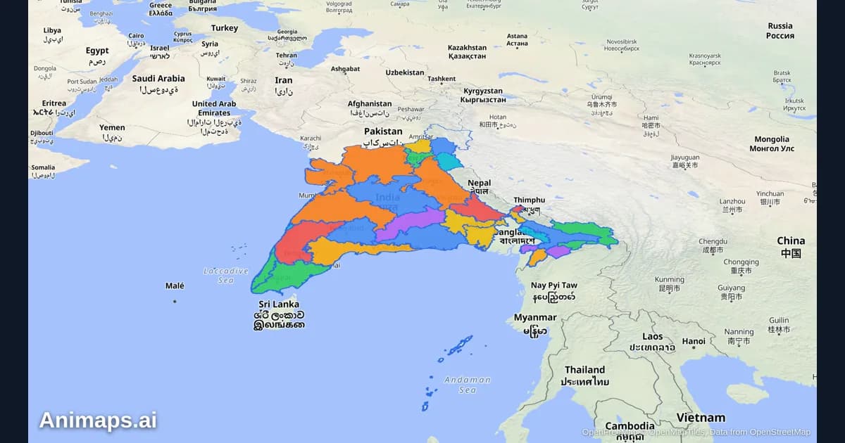
Creating map animations used to require expensive software, hours of manual work, and specialized skills. But AI-powered tools are changing the game. Let's compare the old way with the new way.
Browse every article in the Animaps blog.